Imagine building a massive bridge, creating a detailed map, or managing a disaster relief operation without accurate positioning data. Sounds impossible, right? That’s where geodetic networks step in. These fascinating systems are the unsung heroes of global navigation, land surveying, and even earthquake monitoring.
What Are Geodetic Networks?
At its core, a geodetic network is a system of interconnected points on the Earth’s surface, precisely measured and used as reference points for various applications. Think of it as the backbone of modern surveying and navigation systems.
A Quick History Lesson
Geodetic networks date back centuries. Early surveyors used stars to measure land and relied on basic tools like chains and compasses. Fast forward to today, and we’re talking about Global Navigation Satellite Systems (GNSS) and laser scanning technologies. Pretty cool evolution, right?
What Do Geodetic Networks Do?
These networks are the cornerstone of accurate:
- Mapping and Cartography: Every map you’ve ever used owes its accuracy to geodetic networks.
- Navigation Systems: From GPS in your car to planes crossing oceans, geodetic networks guide us.
- Scientific Research: Measuring tectonic plate movements, studying sea-level rise, and more.
- Engineering Projects: Building skyscrapers, roads, and tunnels demand pinpoint accuracy, and geodetic networks deliver.
Fun Fact:
Did you know that the Eiffel Tower’s exact position is referenced in a European geodetic network? So next time you see it, think of it as more than just a marvel of engineering—it’s also a geodetic marker!

Why Are Geodetic Networks Important?
Geodetic networks might not be something you think about daily, but they’re quietly working behind the scenes, keeping the world running smoothly. Without them, we’d face chaos in transportation, construction, and even disaster management. Let’s dive deeper into their significance.
1. Enabling Precise Positioning and Measurement
Ever wonder how your GPS app can tell you exactly where you are? That’s thanks to geodetic networks. By providing a consistent framework of reference points, these networks make it possible to pinpoint locations with incredible precision—down to the millimeter in some cases!
2. Supporting Global Navigation Systems
Systems like GPS, GLONASS, Galileo, and BeiDou rely on geodetic networks to function. These systems are crucial for:
- Guiding airplanes across continents.
- Directing ships through treacherous waters.
- Helping you find the nearest pizza place. 🍕
Without geodetic networks, navigation systems would be as unreliable as asking a toddler for directions!
3. Advancing Scientific Research
Geodetic networks are the backbone of many scientific studies, such as:
- Monitoring tectonic plate movements to predict earthquakes.
- Measuring the melting rates of glaciers to track climate change.
- Studying sea-level rise to understand its impact on coastal areas.
Case Study: Tectonic Movements in Japan
Japan’s robust geodetic network helped scientists detect subtle shifts in tectonic plates before the devastating 2011 Tōhoku earthquake. While it didn’t prevent the disaster, it provided crucial data for future research and preparedness.
4. Improving Disaster Management
From mapping flood zones to tracking hurricanes, geodetic networks play a pivotal role in disaster management. They provide the data needed to create accurate models, which are used to:
- Evacuate areas at risk.
- Design infrastructure that can withstand disasters.
- Plan effective relief efforts.
5. Underpinning Modern Infrastructure
Building roads, bridges, tunnels, and skyscrapers requires precise measurements. Geodetic networks ensure:
- Accurate alignment of structures.
- Proper drainage and elevation designs.
- Reduced errors during construction, saving time and money.
Fun Fact:
The Channel Tunnel (connecting the UK and France) was aligned using geodetic networks. Engineers started digging from both sides and met perfectly in the middle—a testament to the accuracy of geodetic data!

Types of Geodetic Networks
Geodetic networks come in various forms, each tailored to specific purposes and requirements. Let’s explore the different types, from local setups to global systems that span the planet.
Horizontal Geodetic Networks
Horizontal geodetic networks focus on measuring and defining positions in a horizontal plane. Think latitude and longitude—they’re all about “where” something is on the Earth’s surface.
Key Characteristics
- Measurement Focus: Angles and distances between points.
- Applications: Land boundary surveys, urban planning, transportation networks.
- Tools: Traditional theodolites, modern GNSS equipment, and total stations.
Use Case: Boundary Demarcation
Horizontal geodetic networks are critical for defining national borders and property boundaries. For instance, the Canada-US border’s precise alignment is based on these networks.
Vertical Geodetic Networks
Vertical networks, on the other hand, deal with elevations. They help us measure height differences relative to a baseline, often sea level.
Key Characteristics
- Measurement Focus: Elevation and height.
- Applications: Floodplain mapping, construction, hydrography.
- Tools: Spirit levels, barometers, and GNSS with altitude readings.
Importance in Flood Management
By mapping areas prone to flooding, vertical geodetic networks enable the creation of early warning systems and help governments design better drainage systems.
2D vs. 3D Geodetic Networks
2D Networks
- Represent positions on a flat plane (latitude and longitude).
- Used primarily for mapping and land surveys.
3D Networks
- Include vertical components, giving a complete spatial representation.
- Essential for projects like satellite positioning and structural engineering.
Fun Thought: If maps were still 2D only, buildings like the Burj Khalifa might end up leaning like the Tower of Pisa!
Global Geodetic Networks
Global geodetic networks are international systems that provide reference points for the entire planet. They play a critical role in monitoring global phenomena.
Key Examples
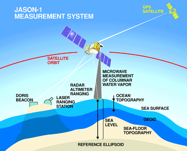
- International Terrestrial Reference Frame (ITRF): Tracks the Earth’s shape, rotation, and gravitational field.
- Global Navigation Satellite Systems (GNSS): Includes GPS, GLONASS, and Galileo.
Applications
- Climate monitoring: Tracking changes in sea levels and polar ice caps.
- Satellite navigation: Ensuring global accuracy for positioning systems.
Fun Fact:
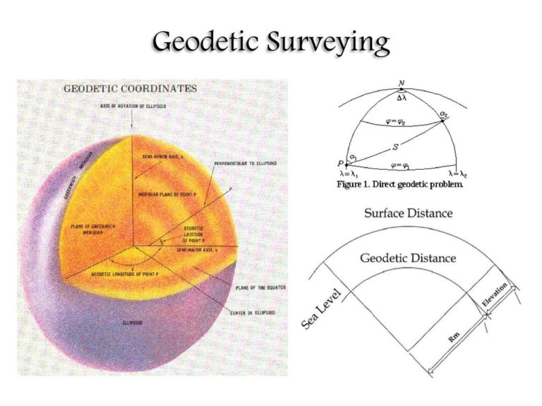
Did you know that Earth isn’t a perfect sphere? It’s an oblate spheroid, slightly flattened at the poles and bulging at the equator. Global geodetic networks account for this irregular shape!
Regional and Local Geodetic Networks
Unlike global systems, regional and local networks focus on smaller, localized areas.
Applications
- Supporting city planning and local infrastructure projects.
- Monitoring land subsidence in specific regions.
- Providing data for regional disaster preparedness.
Challenges
- Maintaining consistency with global networks.
- Dealing with environmental factors like shifting tectonic plates or extreme weather.
Real-World Example
The California geodetic network monitors fault lines, providing critical data to engineers and emergency planners to mitigate earthquake risks.

Components of Geodetic Networks
A geodetic network is only as good as its components. These elements ensure the network’s accuracy, reliability, and functionality. Let’s break down the key building blocks that make geodetic networks work.
Control Points
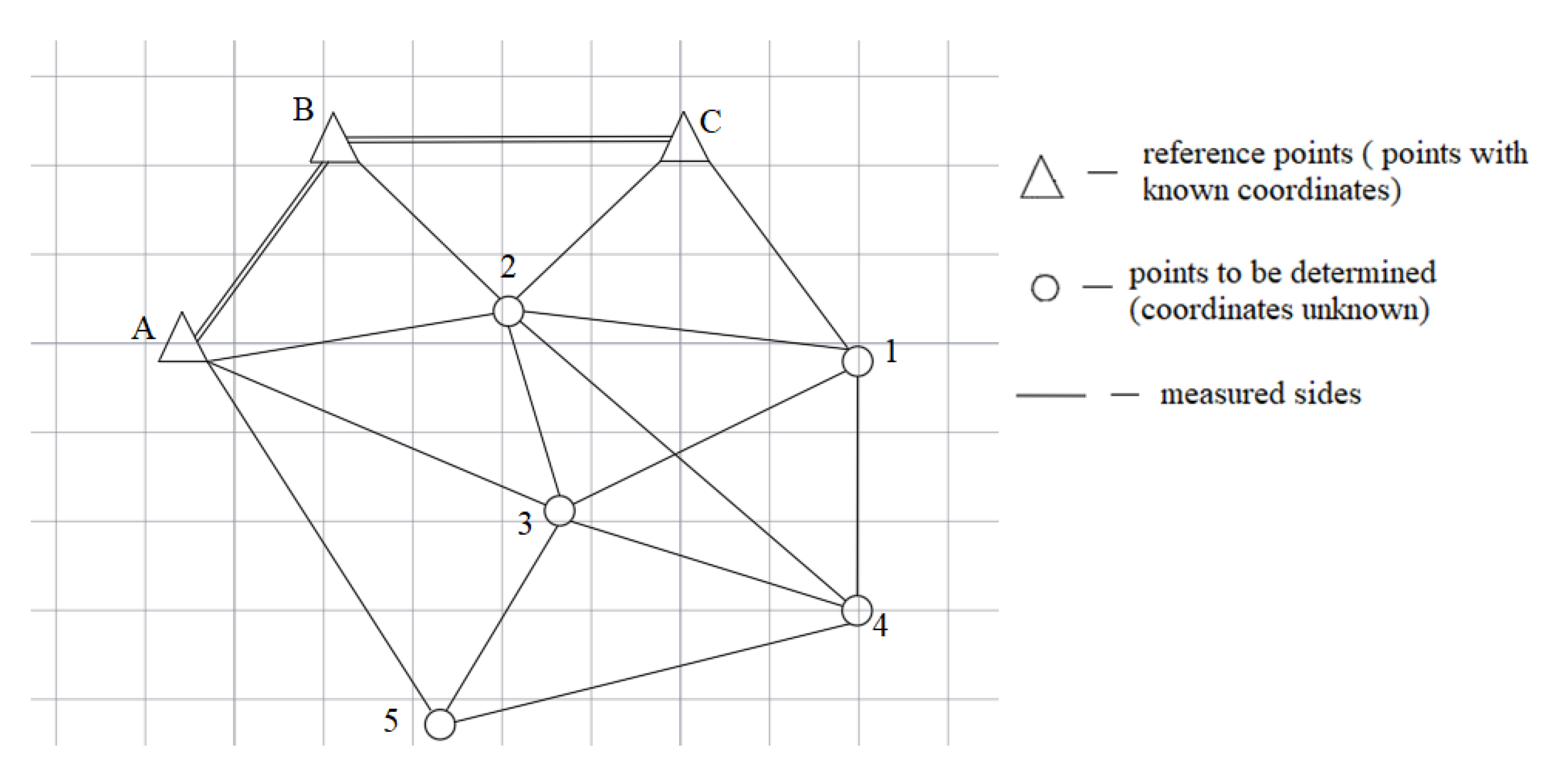
Control points are the backbone of geodetic networks. These are fixed, precisely measured locations used as reference markers for surveys and measurements.
Types of Control Points
- Primary Control Points:
- These are the most accurate and stable points in a network.
- Often established using advanced methods like GNSS or triangulation.
- Secondary Control Points:
- Slightly less accurate but more numerous.
- Used to extend the primary network for practical applications.
- Auxiliary Points:
- Serve local or specific purposes, such as construction projects.
- Less permanent but still tied to the main network.
Fun Fact:
Some control points are so stable that they’ve been in use for over a century! For instance, a triangulation station in the UK, established in 1784, is still referenced today.
Instruments and Tools Used
From basic tools to cutting-edge technology, geodetic networks rely on a variety of equipment to maintain their precision.
Traditional Tools
- Theodolites: Measure angles between points with high accuracy.
- Levels: Determine height differences between points.
Modern Tools
- GNSS Receivers:
- Use satellite signals to provide precise 3D positioning.
- Essential for global and regional geodetic networks.
- Total Stations:
- Combine the functions of theodolites and electronic distance measurement (EDM) devices.
- Widely used in modern surveying.
- Drones and LiDAR:
- Provide high-resolution spatial data.
- Especially useful for mapping inaccessible areas.
Emerging Technologies
- InSAR (Interferometric Synthetic Aperture Radar):
- Tracks ground deformation using satellite radar.
- Quantum Sensors:
- Offer unprecedented accuracy by measuring gravitational differences.
Geodetic Datums
A geodetic datum is a mathematical model that defines the shape of the Earth and serves as a reference for all measurements.
Key Types
- Horizontal Datums:
- Define positions in a 2D coordinate system.
- Example: WGS84, the basis for GPS.
- Vertical Datums:
- Measure heights relative to a base level, often mean sea level.
Importance
Without a consistent datum, measurements would vary wildly. Imagine trying to build a bridge when engineers on each side are using different “Earth shapes”!
Communication and Data Management Systems
Modern geodetic networks rely heavily on software and communication systems to collect, process, and analyze data.
Examples
- Real-Time Kinematic (RTK) Systems: Provide real-time corrections for GNSS measurements.
- Geographic Information Systems (GIS): Manage and visualize geodetic data in a user-friendly way.
Importance of Data Security
Since geodetic data is often used in critical applications, it’s vital to protect it from cyber threats. Secure communication protocols and encrypted storage are standard practices.

How Are Geodetic Networks Designed?
Designing a geodetic network isn’t just about picking a few spots and taking measurements. It’s a meticulous process that involves science, technology, and a healthy dose of foresight. Let’s explore the principles, challenges, and modern advances in designing these networks.
Key Principles and Considerations
Designing an effective geodetic network requires balancing multiple factors:
- Accuracy and Precision
- The primary goal is to minimize errors. Each point must be measured with extreme care to ensure consistency across the network.
- Techniques like triangulation, trilateration, and GNSS-based positioning help achieve this.
- Coverage and Redundancy
- The network must provide sufficient coverage of the area while maintaining redundancy. This means including additional points to verify and cross-check measurements.
- Example: In earthquake-prone regions, redundancy ensures reliable data even if some points shift due to tectonic activity.
- Cost-Effectiveness
- Budget constraints often dictate the choice of instruments and the density of control points. Designers must strike a balance between accuracy and affordability.
- Environmental Factors
- Locations for control points should be stable and accessible, avoiding areas prone to flooding, landslides, or construction.
Fun Thought:
Imagine designing a geodetic network in a dense jungle! Surveyors often face challenges like hostile terrain, wildlife, and unpredictable weather. It’s like a real-world treasure hunt—with fewer pirates.
Challenges in Designing Geodetic Networks
- Geophysical Changes
- The Earth is constantly shifting due to tectonic movements, volcanic activity, and even human activities like mining. These changes can alter control points, requiring frequent recalibration.
- Interferences
- Urban environments pose challenges like signal interference from tall buildings or electromagnetic disruptions from power lines.
- In rural or remote areas, accessibility and infrastructure limitations can complicate the process.
- Human Error
- Despite advances in technology, human oversight during data collection or processing can introduce errors. Double-checking and automation are vital to minimize these risks.
Advances in Network Design
Modern technology is revolutionizing how geodetic networks are designed and maintained:
- Automation and AI
- Automated systems and artificial intelligence are now used to identify optimal control point locations and process large datasets efficiently.
- Satellite Technologies
- Satellites like those in the GNSS constellation provide highly accurate positioning data, reducing the need for extensive ground-based measurements.
- Real-Time Monitoring
- Advanced systems now allow for real-time adjustments to networks. For instance, stations in seismic zones can instantly detect and account for ground shifts.
Case Study: European Plate Observing System (EPOS)
EPOS integrates real-time geodetic data from across Europe to monitor tectonic activity and support disaster response efforts. This system showcases how cutting-edge technology can enhance network design.
Traditional vs. Modern Network Design Approaches
| Aspect | Traditional Approach | Modern Approach |
|---|---|---|
| Tools | Theodolites, chains, manual levels | GNSS, drones, LiDAR, AI |
| Data Processing | Manual calculations | Automated software systems |
| Coverage | Local and limited | Global and scalable |
| Accuracy | Subject to human error | Highly precise (millimeter-level) |
| Time and Cost | Time-intensive and expensive | Faster and more cost-effective |
Geodetic network design is where science meets creativity. It’s about crafting a system that stands the test of time, environmental changes, and technological evolution.