Imagine standing on a solid piece of ground, confident it’s not moving. Now imagine being told that, even as you stand there, the ground beneath you might be shifting—albeit at a microscopic level. This movement, whether from tectonic plates, subsiding cities, or swelling volcanoes, is what geodetic monitoring seeks to measure.
Geodetic monitoring, simply put, is the science of observing, measuring, and analyzing changes in the Earth’s shape, gravity field, and rotation. It plays a crucial role in understanding natural phenomena, predicting disasters, and managing infrastructure in our rapidly changing world.
So, why should you care? Because geodetic monitoring is the unsung hero of everything from accurate GPS navigation to climate change research.

What Is Geodetic Monitoring?
Geodetic monitoring is a branch of geodesy, which is the science dedicated to measuring and understanding Earth’s geometry. Think of geodesy as a toolbox, and geodetic monitoring as the tool that keeps tabs on Earth’s dynamic changes—like a personal trainer for our planet, but without the yoga mats.
The process involves precise measurements of Earth’s surface movements, gravitational variations, and rotational axis shifts. These measurements might sound abstract, but their impact is anything but. They help detect earthquake risks, monitor infrastructure stability, and even measure the effects of melting glaciers on sea levels.
The History of Geodetic Monitoring
Geodetic monitoring has ancient roots. Early Egyptians and Greeks relied on basic surveying techniques to map land boundaries. Fast forward to the 18th century, and advances in astronomy allowed for more precise measurements of Earth’s shape and size. In the modern era, we’ve taken things to another level with satellites, lasers, and GPS technology, enabling real-time monitoring of Earth’s movements.
The Importance of Geodetic Monitoring
- Disaster Prediction and Prevention: By monitoring fault lines and crustal movements, geodetic systems provide data that help forecast earthquakes or volcanic eruptions.
- Climate Change Research: Tracking glacier melt and sea-level rise is crucial for understanding global warming.
- Infrastructure Safety: Engineers use geodetic monitoring to ensure the stability of bridges, dams, and buildings.
- Space Exploration: Precise measurements aid in launching and tracking satellites and space missions.
Think of geodetic monitoring as the quiet observer that makes sure humanity doesn’t miss the critical signs Earth is giving us.

The Fundamentals of Geodetic Monitoring
To fully appreciate geodetic monitoring, let’s dive into its building blocks. From understanding the science behind it to the tools and techniques used, will give you a comprehensive look at the fundamentals of geodetic monitoring.
Key Concepts in Geodesy
Geodesy is the backbone of geodetic monitoring. It’s the science that answers some very nerdy but important questions:
- What is the exact shape of Earth? (Spoiler: it’s not a perfect sphere, but an oblate spheroid.)
- How does gravity vary across the planet?
- How does Earth’s position in space change over time?
These questions are essential for monitoring natural and human-induced changes on the planet. Geodetic monitoring, as a subset of geodesy, focuses on detecting and measuring these changes with pinpoint accuracy.
For example, when you hear about Earth’s poles shifting due to melting ice caps, that’s geodetic monitoring in action. It’s a lot like watching Earth wobble in slow motion.
Tools and Technologies Used
Geodetic monitoring relies on some seriously cool tools. Here’s a breakdown:
- GNSS (Global Navigation Satellite Systems)
- Best known for powering GPS in your car or smartphone, GNSS also tracks tectonic plate movements and measures land deformation.
- Fun fact: GNSS can detect ground shifts as small as a few millimeters!
- Total Stations and Theodolites
- These optical instruments measure angles and distances between points. Perfect for precise surveys of infrastructure and natural landscapes.
- LiDAR (Light Detection and Ranging)
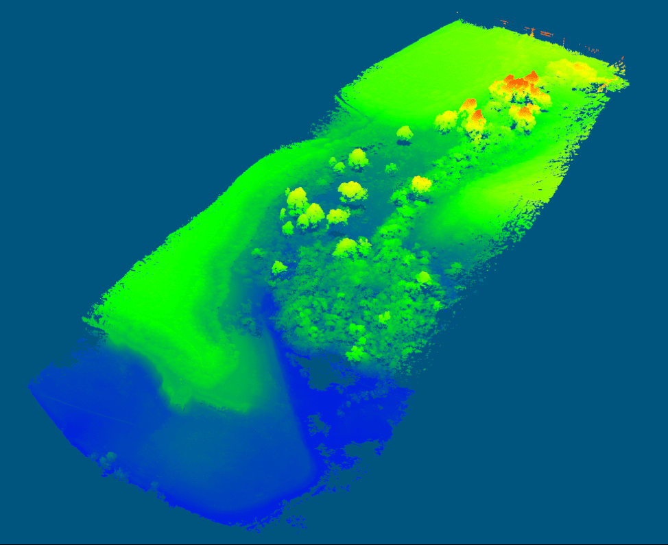
- LiDAR uses laser beams to create detailed 3D maps of terrain. Imagine Google Maps on steroids.
- Satellite Altimetry
- Measures the height of Earth’s surface, especially over oceans. Crucial for studying sea-level rise and ocean circulation.
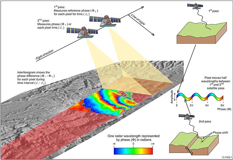
- InSAR (Interferometric Synthetic Aperture Radar)
- A radar-based system that detects ground deformation by comparing satellite images taken over time. Think of it as a super-advanced “spot the difference” game.
Each of these technologies provides unique data, which, when combined, gives scientists a detailed picture of how our planet is changing.
Types of Geodetic Measurements
Geodetic monitoring doesn’t just measure one thing—it’s a multi-dimensional effort. Here are the primary types of measurements:
- Horizontal and Vertical Movements
- Horizontal measurements track the sideways motion of tectonic plates.
- Vertical measurements monitor subsidence (sinking land) or uplift, often caused by earthquakes or volcanic activity.
- Rotational Measurements
- These track changes in Earth’s rotational axis. Did you know melting glaciers can actually shift Earth’s spin? Wild, right?
- Time-Based Geodetic Data
- Long-term monitoring helps identify patterns, like the gradual sinking of coastal cities due to rising seas or subsiding ground.
These measurements are like puzzle pieces that fit together to show the bigger picture of Earth’s dynamic nature.
Making It Relatable
Here’s a quick analogy: Think of Earth as a giant ball of pizza dough. Sometimes it stretches (tectonic plates pulling apart), sometimes it rises (volcanic activity), and sometimes gravity makes it sag in places (subsidence). Geodetic monitoring is the baker watching all these changes, making sure the dough doesn’t tear or collapse.

Applications of Geodetic Monitoring
Geodetic monitoring isn’t just about measuring the Earth for the sake of curiosity—though that’s pretty cool, too. It has a wide array of practical applications that impact everything from disaster preparedness to urban planning. Let’s explore how this science is making a real difference.
Natural Hazard Monitoring
Mother Nature doesn’t always give clear warnings before disasters strike, but geodetic monitoring can provide crucial clues. Here’s how:
- Earthquake Prediction and Fault Movement
- By tracking tectonic plate shifts and strain buildup along fault lines, geodetic monitoring helps scientists identify areas at risk of earthquakes.
- For instance, GPS networks along the San Andreas Fault provide continuous data on its creeping motion, helping refine earthquake risk models.
- Volcanic Activity Monitoring
- Before a volcano erupts, magma moving underground often causes ground deformation. Tools like InSAR can detect these subtle changes, giving authorities time to issue warnings.
- Case Study: The 2018 eruption of Hawaii’s Kīlauea Volcano was closely monitored using geodetic techniques, enabling timely evacuations.
Infrastructure and Urban Planning
Geodetic monitoring is a silent guardian for the world’s infrastructure. Engineers and urban planners rely on it to prevent catastrophic failures and ensure long-term stability.
- Monitoring Subsidence in Cities
- Cities like Jakarta and Venice are sinking due to groundwater extraction and rising sea levels. Geodetic monitoring helps track these changes to inform mitigation strategies.
- Data Example: Jakarta is sinking at an alarming rate of up to 10 centimeters per year in some areas.
- Stability Assessment of Critical Structures
- Bridges, dams, and skyscrapers need to be monitored for subtle shifts that could indicate structural weaknesses.
- For example, the Millau Viaduct in France, one of the tallest bridges in the world, undergoes regular geodetic monitoring to ensure safety.
Environmental Applications
The Earth is changing rapidly, and geodetic monitoring helps us understand and respond to these shifts.
- Climate Change Tracking
- Glacier Melt: By measuring changes in ice sheet thickness, geodetic monitoring quantifies the contribution of glaciers to sea-level rise.
- Sea-Level Rise: Satellite altimetry tracks even small increases in ocean height, a key indicator of global warming.
- Forest and Land Use Monitoring
- LiDAR and satellite imagery help monitor deforestation and land degradation, supporting conservation efforts.
- Fun fact: Geodetic data contributed to mapping the Amazon Rainforest’s carbon storage capacity!
Navigation and Space Exploration
It’s not just Earth scientists who benefit from geodetic monitoring—space agencies and navigators rely on it, too.
- Improving GPS Accuracy
- Your GPS wouldn’t be as reliable without geodetic monitoring. By accounting for tectonic shifts and other Earth changes, geodetic data keeps GPS systems precise.
- Example: The U.S. GPS network uses geodetic monitoring to correct for plate tectonics, ensuring your maps app doesn’t lead you astray.
- Satellite Tracking and Space Missions
- Geodetic techniques are used to track satellites, ensuring they stay in the correct orbit.
- Agencies like NASA and ESA use geodetic monitoring for mission planning and navigation, including Mars rover landings.
Summary Table of Applications
| Application Area | Specific Use Cases | Impact |
|---|---|---|
| Natural Hazard Monitoring | Earthquake and volcanic activity tracking | Saves lives through early warnings |
| Infrastructure Safety | Monitoring bridges, dams, and cities | Prevents catastrophic structural failures |
| Climate Change Research | Glacier and sea-level monitoring | Informs global climate policies |
| Navigation and Space | GPS accuracy and satellite tracking | Enhances technology and exploration efforts |
A Personal Note
If you’ve ever used GPS, flown in a plane, or lived near a fault line, you’ve benefited from geodetic monitoring—even if you didn’t realize it. It’s the quiet workhorse behind so many modern conveniences and safety measures, proving that sometimes the most important things are the ones we never notice.

How Does Geodetic Monitoring Work?
Geodetic monitoring is like the Sherlock Holmes of Earth science—it gathers clues, pieces together patterns, and solves mysteries about how our planet behaves. But how does it actually work?
Data Collection Methods
The first step in geodetic monitoring is collecting data. This involves a mix of ground-based and satellite technologies.
- Station-Based Monitoring
- Permanent GNSS Stations: Fixed stations worldwide continuously track tectonic plate movements, land deformation, and atmospheric changes.
- Total Stations and Theodolites: These instruments are often used in construction or for monitoring local-scale movements, like a bridge swaying in the wind.
- Satellite-Based Monitoring
- Satellites in Low Earth Orbit (LEO) collect high-resolution data for large-scale observations.
- Examples include NASA’s GRACE (Gravity Recovery and Climate Experiment) satellites, which measure changes in Earth’s gravity caused by shifting masses, like melting glaciers.
- Mobile Systems
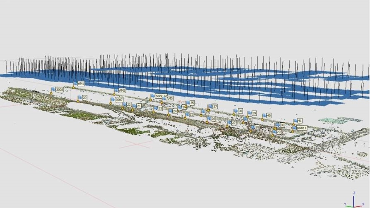
- Unmanned Aerial Vehicles (UAVs) equipped with LiDAR provide rapid, localized geodetic measurements.
- Case Study: After the 2021 Turkey earthquake, UAVs were deployed to map ground deformation and assist in recovery efforts.
Processing and Analysis
Once the data is collected, the real magic happens in processing and analysis. Raw numbers become actionable insights through complex algorithms and models.
- Data Integration
- Different types of data—GPS, LiDAR, InSAR—are integrated to create a complete picture of the monitored region.
- Example: By combining GNSS and InSAR data, scientists can detect both horizontal and vertical land movements with incredible precision.
- Modeling and Simulations
- Mathematical models predict future changes, such as how a fault line might behave over the next decade.
- Advanced simulations help anticipate the impact of events like tsunamis or glacial collapse.
- AI and Machine Learning
- AI algorithms analyze vast datasets to identify patterns humans might miss.
- Real-world Use: AI has been used to improve earthquake prediction models, reducing false alarms while enhancing accuracy.
Key Metrics Monitored
Geodetic monitoring isn’t about one-size-fits-all metrics. Each project focuses on specific measurements, depending on the goal.
- Surface Deformation
- Tracks how land shifts over time.
- Example: Subsidence in Mexico City is measured to be up to 50 cm/year in some areas due to groundwater extraction.
- Gravity Field Changes
- Monitors how Earth’s gravity varies, often linked to mass redistribution, like ice melting or groundwater depletion.
- Rotational Axis Movements
- Earth’s spin axis isn’t fixed; it wobbles due to changes in mass distribution, like melting polar ice caps.
Simplifying the Complexity
If all this sounds a bit like a sci-fi movie, think of it this way: Geodetic monitoring works by keeping an eye on the big things—tectonic plates, glaciers, gravity shifts—while never losing sight of the tiny, millimeter-scale details. It’s like juggling bowling balls and marbles at the same time, and doing it flawlessly.